Have you ever wondered how traditional land surveying methods impact the environment? Bulldozers clearing paths, vehicles emitting harmful gases, and surveyors trudging through delicate ecosystems can leave behind a trail of ecological damage.
What if there were a more sustainable, efficient, and accurate way to assess land? Enter drone surveys, a revolutionary, eco-friendly solution reshaping land analysis while minimizing harm to the planet. By adopting drone technology, you not only save time and resources but also actively contribute to environmental conservation.
Let’s explore the significant ways drones make land surveys sustainable while offering unparalleled benefits.

Significantly Reducing Carbon Emissions
Traditional land surveys often require heavy machinery, multiple vehicles, and prolonged human presence, all of which contribute to substantial carbon emissions. In contrast, drones use lightweight, battery-powered systems that operate efficiently without fossil fuels.
For example, consider a large-scale agricultural survey. Conducting it traditionally might involve fuel-powered equipment operating for days. However, a drone can complete the task in mere hours, emitting virtually no harmful pollutants.
This surprising reduction in emissions not only benefits the environment but also lowers your operational costs. This makes drone surveys a highly advantageous option.
Protecting Fragile Ecosystems with Precision and Care
Traditional surveying always involves physical interaction with the land, which may damage natural habitats, harm wildlife, and even destroy some fragile ecosystems. However, drones allow you to do this from the sky with very minimal disturbance to the environment below.
For example, if you need to survey a wetland area teeming with endangered species. Using traditional methods risks damaging flora and fauna through trampling or equipment placement. With drones, you can capture detailed, high-resolution data from above, preserving the ecosystem while achieving superior accuracy.
Decreasing Waste Through Accurate Data Collection
Inaccurate land surveys can lead to wasteful project revisions, material overuse, and unintended environmental damage. However, drone surveys provide precise data through advanced imaging and real-time analytics, drastically reducing the margin for error.
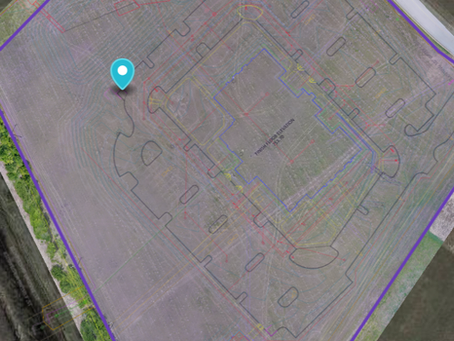
For example, if you’re planning a construction project, drones can generate 3D maps and thermal imaging data to pinpoint exact site details. This prevents over-excavation, minimizes material wastage, and ensures sustainable land use practices saving both the environment and your budget from unnecessary strain.
Saving Natural Resources with Faster Surveys
Time-consuming surveys mean prolonged exposure to the land, consuming more fuel, manpower, and resources. Drones excel by completing complex surveys quickly and efficiently, conserving these critical resources.
Take forestry management as an example. Traditional surveys might take weeks of labor-intensive effort, including tree marking and terrain mapping. A drone, however, can accomplish this in hours, allowing you to allocate resources more effectively while avoiding prolonged environmental impact.
Promoting Renewable Practices with Reusable Technology
Unlike many traditional survey tools that wear out or require frequent replacements, drones are durable, reusable, and easily maintained. Modern drones operate on rechargeable batteries, aligning with renewable energy practices and further reducing their ecological footprint.
For example, solar power charging stations for drones have become very popular in remote surveying operations of surveying. These not only ensure continuous usage without dependence on nonrenewable energy sources but also demonstrate a commitment to sustainable practices. By investing in drones, you contribute to a cycle of responsible resource use that benefits the environment in the long term.
Conclusion
The environmental benefits of drone surveys are obvious and appealing: less emission, conserved ecosystems, waste reduced, resources saved, and renewable practices in place. If you are concerned about sustainability and efficiency, adopting drone technology places you among the best of the most eco-conscious land analysis professionals.
Just think about the difference you can make, not just for your projects but for the planet itself. Drones are your step toward standing up for innovation and for the cause of environmental stewardship in a brighter, greener future.
So why stick to outdated, damaging methods when a smarter, more sustainable alternative is right at your fingertips? The time to transform how you approach land surveys is now. Let drones lead the way to a more sustainable tomorrow.
Ready to take your projects to the next level with eco-conscious precision? Choose a commercial construction service that integrates drone surveys for sustainable, accurate land analysis. Contact MAP Drone Solutions and build a greener tomorrow!


