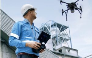
Commercial property evaluations can be tricky, especially when you are in the process of land acquisition or building construction. The introduction of drones has revolutionized land inspection by streamlining operations, improving assessments, and enhancing efficiencies. Whether it’s being used by a developer, realtor, or property owner, the benefits of drones are abundant at every stage of the commercial real estate lifecycle.
Here is our list of recommendations for drone use in property evaluations.

Land Acquisition
Land acquisition forms the basis of any commercial real estate project, but following the traditional process can take time and effort. Drones are now transforming this crucial stage by offering faster and more accurate methods of site identification and environmental assessments.
- Faster and More Accurate Site Identification
The use of drone technology considerably improves the speed of the land acquisition process. With their high-resolution cameras, drones can image vast areas quickly and provide detailed aerial views that may be challenging to capture on the ground. This saves time and helps better identify potential development sites, allowing commercial realtors to focus on the best opportunities.
- Improved Environmental Impact Assessments
An environmental analysis is a crucial step to consider before investing in any land. Drones equipped with specific sensors could acquire information on a particular topography, vegetation, and water body. Such data could be used in environmental impact assessments to focus on the nature of regulatory hurdles and site suitability for development.
- Enhanced Due Diligence with Aerial Mapping and Imaging
Land purchase always involves due diligence in scrutinizing any problems a site might have. Drones can construct 2D and 3D maps with high resolution that might not be visible by traditional survey methods. Such maps may highlight features such as boundary lines, access points to a property, and neighboring properties. This makes the due diligence process meticulous, and costly surprises are avoided later.
Construction
Construction is the next phase after acquiring the land. This stage tends typically to be complex and resource-intensive. Drones, therefore, make this stage straightforward by enhancing site monitoring and improving communication between stakeholders.
- Efficient Construction Site Monitoring
It’s hard to keep up with large commercial building construction sites. Drones prove to be efficient tools because they capture aerial images and videos of the site. What the drone captures may contain aspects not easily accessed by humans, offering scope for real-time assessments of project progress by the project managers. Thus, they can plan future tasks accordingly while making sure that the project stays on course.
- Real-Time Project Updates for Stakeholders
Periodic updates allow information consistency among the participants. Drones can take real-time footage of the project site, which will be shared with the stakeholders so they can have an aerial view of what is happening there. Such transparency creates better communication, eliminates numerous visits to the site, and ensures that everyone is keenly aware of the project’s development status.
- Detection of Safety Hazards and Quality Control Issues
Drones are valuable tools for detecting potential safety hazards and quality control issues on construction sites. Stored materials or structural deviations from the plans are a few examples of early detection, followed by intervention, which helps reduce risks, maintain the safety standard, and ensure the quality of a project meets expectations.
Building Completion
As the construction phase is finalized, the final stages of this process will focus on fully aligning the structure with the needs and demands of regulations and making it ready for sale or lease. Drones play a massive role in making this last phase efficient and complete.
- Rapid Inspection of Completed Structures
Inspection of large, newly constructed towers can be extremely time-consuming. Drones could save much time by inspecting inaccessible areas like rooftops and tall sections and providing high-resolution images that affirm that the buildings are actually built according to the original design specification.
- Verification of Compliance with Regulations and Codes
Verifying whether the building meets local requirements is vital to avoid fines or costly adjustments. Drones make it easier to verify compliance by taking broad photos of critical areas, such as fire escapes and rooftop installations. They thereby provide a more efficient avenue to confirm that all requirements have been met.
- Facilitation of Final Walkthroughs and Documentation
Drone technology also makes final walkthroughs easier by recording video footage from various angles of the completed property. Such walkthroughs provide the most realistic view for prospective buyers or tenants and serve as a multimedia record of the state of the property when completed, useful for future reference.
Conclusion
A game-changer in the commercial real estate industry, drones now deliver advantages at every stage of the land acquisition and building completion process. Their ability to capture high-quality aerial images and videos, detect safety issues, and provide real-time information updates makes them a goldmine for developers and owners as well.
Ready to take your commercial real estate projects to the next level? Call MAP Drone Solutions today to experience professional drone services, including aerial drone roof inspection, site monitoring, and so much more. Unlock the full power of drone technology in your next real estate venture.
