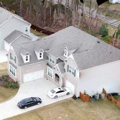
The heavy civil and earthworks sectors now analyze their worksites using drone mapping and surveying.
Without compromising precision, unmanned aerial vehicles (UAVs) provide for quicker and less expensive surveying. They work with little additional training or knowledge needed, so you can gather data as frequently as you’d like. A drone topographic survey also helps in providing safety to your workers.
In this blog, we will delve deeper into how the drone survey works.

Basics of Drone Survey
Drone mapping and surveying involve integrated cameras that allow them to snap pictures of the ground from various angles in the air. A GNSS sensor on the drone records the geo-coordinates of each image, which are then labeled with the precise location of the image in space. Using RTK or PPK processing, the image is “fact-checked” against known locations on the ground for an accurate drone topographic survey.
Hundreds or even thousands of photos are taken during a single drone flight, and they are processed using photogrammetry software. The software “stitches” the images together to produce 3D models or geo-referenced orthomosaics of a work site. Then, those 3D maps can be examined in depth to obtain precise data regarding project quantities, distances, elevations, and inventory.
Businesses may safely and adequately track changes and progress by gathering this data on a regular basis and comparing the maps to design files and past surveys. Drones can collect highly detailed data far more quickly and at a lesser cost than a base and rover. Additionally, drones can gather aerial photos from areas that would be too risky and dangerous for humans to survey manually on foot.
Ground Control: Taking Photos with Drones
A significant number of known points were required for traditional drone mapping and surveying to validate and locate your drone footage on the ground. This is because a drone that lacks kinematic processing capability can only take two-dimensional site photos.
The physical scale of the site significantly impacts the entire time investment. Not to mention that it raises dangers to personnel’s safety when they have to trek across dangerous terrain, enter nearly inaccessible portions of a site, or visit an active site. For these reasons, professionals now prefer using smart ground controls for a drone topographic survey.
Smart Ground Control: The Way Forward
Using intelligent GCPs such as AeroPoints, all you have to do is arrange the hardware in the best possible way throughout the surveyed region. This is far more important than how many GCPs are present in a specific area. To put it simply, you would have to draw a shape around your location and then, using survey best practices, distribute GCPs so that they reach the highest and lowest elevations.
AeroPoints make the procedure significantly easier to implement. A GPS receiver built into the AeroPoint records the pilot’s location for the length of the flight. All it takes to begin logging data is one button press during activation. Once your drone survey is over, hit the button again to send the data to Propeller via Wi-Fi signal—usually a mobile hotspot.
Photogrammetry: Turning Drone Photos into 3D Survey
The study of using photographs to collect data about an object or environment is known as “photogrammetry.” Drone mapping and surveying use photogrammetry, which measures geography and landscapes by processing and analyzing thousands of overlapping airborne drone photographs.
Photogrammetry software can be used to create lifelike 3D reconstructions of topographic surfaces and features. It is done when enough overlapping photos of the same features are combined.
A survey average would allow you to readily identify a wide variety of “features” between images. The number of matching attributes improves your ability to relate images to one another and reconstruct objects portrayed in them.
If you have a large number of these features—millions, in fact—you can build a “cloud” of points. Every point has a corresponding feature that describes the area you scanned there. After that, you can convert your point cloud into any common geospatial software output, such as a digital elevation model (DEM) or 3D mesh.
RTK and PPK: Fixing Positioning Errors
It is necessary to examine and fix any positioning errors in all drone photos obtained during a drone topographic survey. Drone-based real-time kinematic (RTK) processing and post-processing kinematic (PPK) workflows are two methods for guaranteeing survey-grade accuracy.
Post-processing kinematics (PPK) is increasingly being used to process completed surveys. PPK corrects the positional data after the flight by utilizing an RTK-enabled drone and a terrestrial control point. A timestamp that is captured when the drone snaps a picture is used to match those two sets of GPS data once the trip is over.
The initial (less-than-accurate on-board GPS data) is then replaced, providing precise geotags for the drone mapping and surveying imagery. PPK eliminates the requirement for the drone and RTK base station to stay connected while the drone is in flight. Propeller advises PPK over RTK for drone surveying on many types of sites – including landfills, aggregate sites, mining sites, and building sites.
How Will MAP Drone Solutions Help You?
When it comes to maximizing the potential of unmanned aerial vehicles, MAP Drone Solutions is at the forefront. Our adventure began with a desire to use drone capabilities beyond photography. We are currently dedicated to providing cutting-edge drone solutions to both people and companies.
From precise mapping and surveying to aerial photography and videography, our team produces excellent results with unmatched efficiency.
Just fill out our Contact Us form and wait for our response!
