Land surveying has played a crucial role throughout history with the primary purpose of accurately measuring, mapping, and defining the boundaries of land. In today’s world, it continues to hold the same importance (or even more) in various fields. It helps in planning new construction, managing natural resources, disaster management, and many more.
Earlier, land surveying was a slower, labor-intensive, and less accurate process. It required too much time and effort for manual measurements on the ground. However, the arrival of technologies like drones or unarmed aerial vehicles (UAVs) has radically changed land surveying. Drone mapping and surveying of land enables us to get faster and more efficient data collection, overcoming previous limitations in speed and precision.
In this blog, we will talk about the application of drone land surveying and also know the benefits it brings to the table.

The Dynamic Applications of Drone Land Surveying
Drone land surveying is reshaping how we gather data. It’s being used everywhere, from building sites to farms, having a significant impact on many areas. Here are some of the most common applications of drone land surveying.
Construction Site Planning:
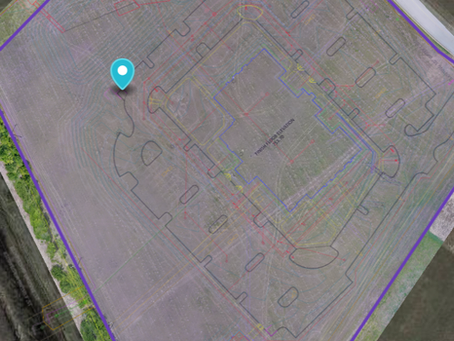
Drone land surveying plays a massive role in construction. They help in mapping and modeling sites in detail. This assists in planning more accurately, tracking advancement, and ensuring accuracy in building structures.
Agricultural Monitoring:
Drone mapping and surveying can help farmers through insights. Farmers can assess crop health, irrigation, and more through it and improvise for efficient, sustainable practices.
Disaster Response and Recovery:
Drones play a vital role in disaster management. They quickly access impacted zones and deliver real-time data to aid rescue operations. They assess damages done and help in planning recovery actions in such challenging conditions.
Environmental Monitoring:
Drones are employed for environmental surveys, helping researchers keep an eye on ecosystems, wildlife, and natural resources. It provides valuable data for ecological studies and helps save our planet.
Infrastructure Inspection:
Drone mapping and surveying can be used to check out crucial structures like bridges, pipelines, and power lines. This way of checking ramps up safety cuts down costs and aids in quick repair times by taking clear and detailed pictures and videos.
Gaining the Competitive Edge: Unveiling the Advantages of Drone Surveying
Efficiency: Drones can cover large areas of land quickly and easily. It makes them much more efficient than the traditional surveying methods.
Cost Effectiveness: Drone mapping can be more affordable than conventional methods, particularly for large or complex projects.
Accuracy: When utilizing drones, they are able to gather high-resolution information with terrific exactness, resulting in maps and models that are more precise.
Safety: Unmanned aerial vehicles can be utilized to inspect risky or hard-to-reach locations. This keeps the surveyor safe.
Map Drone Solutions: Your Partner in Comprehensive Drone Services
At Map Drone Solutions, we’re your go-to team for top-notch drone solutions. With a focus on construction services, we help you submit quicker and more detailed bids to impress your clients. Our job site documentation keeps you in the loop from your office, and our 3D models and online reports ensure everyone is on the same page. We’re not just about business; our aerial cinematography adds flair to your projects. Plus, our inspection services save time and equipment – from roof and tower inspections to solar panels, we’ve got you covered. Trust us for efficient, comprehensive, and hassle-free drone services for drone mapping and surveying, and more!
Conclusion
In conclusion, the world of land surveying has leaped forward with the introduction of drone technology. From construction sites to farms and disaster-stricken areas, the applications are diverse. Drone mapping and surveying provide efficiency, cost-effectiveness, accuracy, and safety. At Map Drone Solutions, we stand as your reliable partner, offering top-notch services for drone land surveying and more. Embrace the future of land surveying with us and witness the transformative impact it brings to your projects.


